
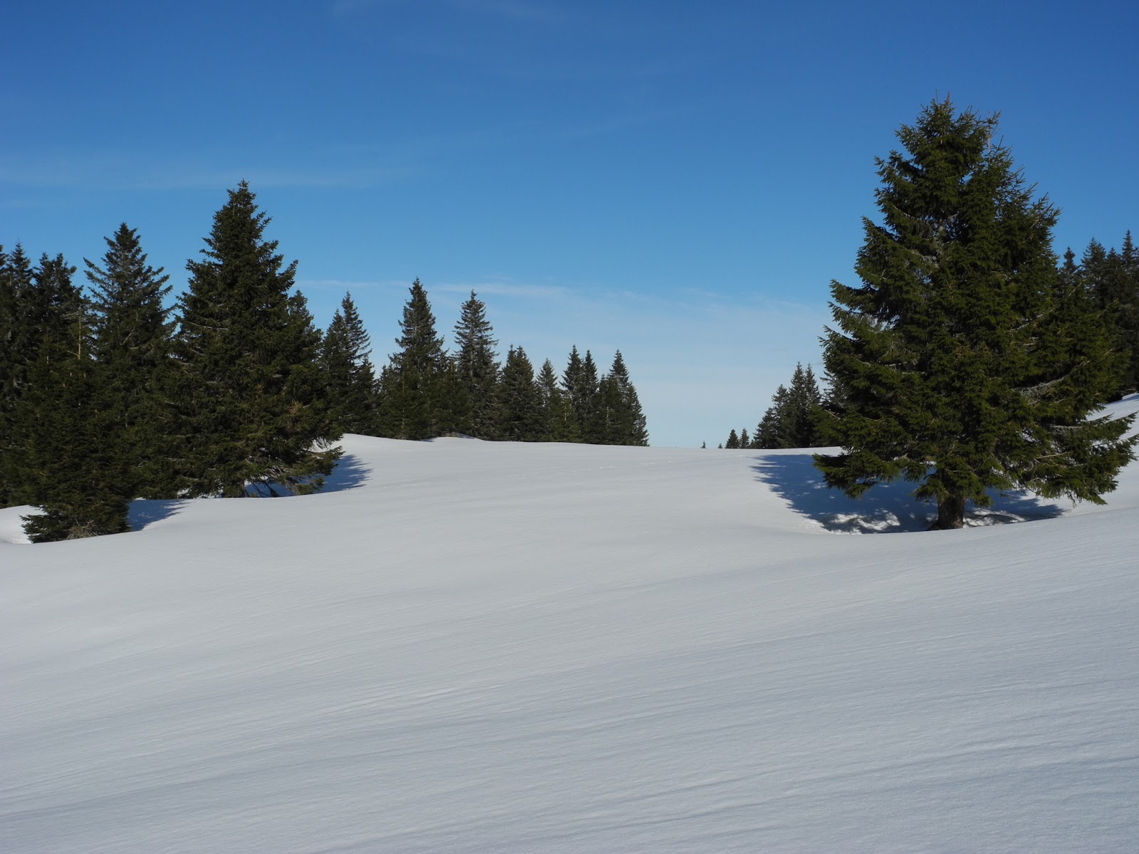
Somewhat hooked on the Col de la Givrine as a snow-shoeing paradise, we decided to make the first walk of 2013 to the Crêt Des Danses - a 1534 metre peak about two kilometres north of Le Noirmont, just a kilometre or so east of the Swiss-French border. Having been there just a week earlier (to climb La Noirmont on the last day of 2012), we knew we'd need a long day to get into the back-country where Crêt des Danses lay hidden, so we made sure we were at La Givrine - our kick-off point - nice and early. Well, early enough - for a holiday day.

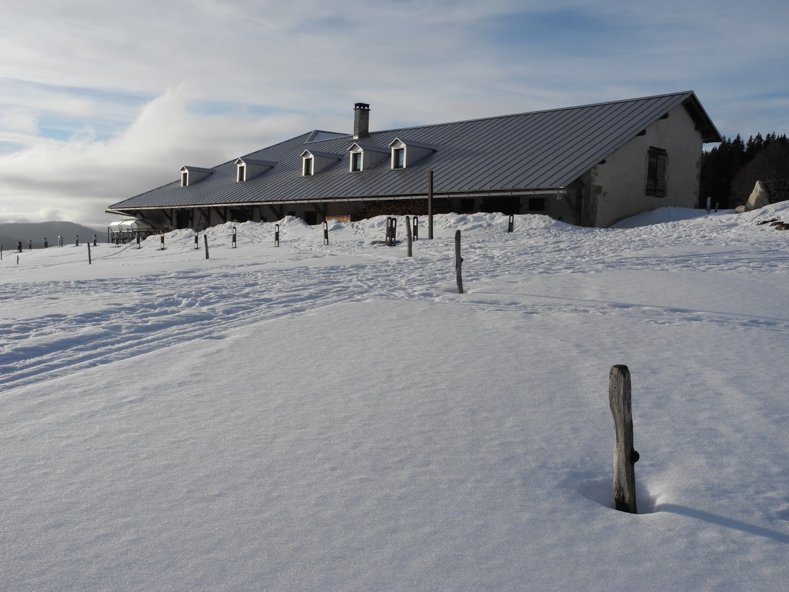
The restaurant at La Givrine - our kick-off point.
We parked the car on the side of the Col de la Givrine road (which runs between St Cergue and La Cure), just below the La Givrine restaurant and, at about 9.30am, headed up the "graded" road that leads towards the popular farmhouse restaurants of La Genolière and Le Vermeilley. There was a light mist hanging around in the valleys around us. Darker, more ominous clouds built-up, then dissipated, over and around La Dôle - which we promptly put to our backs and headed north. Ahead of us the landscape was bathed in bright sunshine, however, with near-freezing temperatures, we set-out wearing snow jackets, beanies and gloves. The forecast had predicted about 3 degrees maximum, and lots of cloud, and expecting a long walk, we were prepared for cold weather - especially later, towards the end of the day.

Heading up the "graded" road north of La Givrine.
Not surprisingly, carrying our snowshoes on our backs, we soon built-up a head of steam as we charged up the road under the forested slopes of La Tourbière, and soon stopped to peel-off our toasty jackets down to long-sleeved t-shirts. So far, so good ... it was turning-out to be a lovely day. Already there wasn't a cloud in sight.

Lis shedding her snow jacket near La Tourbiére.
We passed a lichen-encrusted sign telling us we were entering the Parc Jurassien Vaudois protected area. As it turned out, just like during our previous visit a week earlier, the park once again displayed a plethora of small animal tracks and scats, but virtually nothing sighted. We didn't see a single animal (maybe we're too noisy in our snow shoes), but we did see lots of ravens (my favourite bird), so that was cool.

Entering the Parc Jurassien Vaudois protected area.
We passed by the Glacière de La Genolière (one of those unique Jura underground glaciers that lie trapped in a karst-system cavern as a result of temperature inversions), and soon after, the La Genolière farmhouse restaurant (1348m), which is just south of the road. A gentle zephyr of a wind drifted intermittently across the snow-white landscape, and obliged with just enough strength at the right time to lift the listless Swiss flag just long enough for me to take one of those "typically Swiss" postcard snapshots. Having thus obliged, and done its duty, the wind dropped, the flag sighed, and once again drifted back to its slumbering pose adjacent to its flagpole.

La Genolière alpage restaurant.
We followed the road further eastwards - through a valley called the Grande Combe, which looked absolutely magic in the early morning mist and diffused sunlight. Lis often strolled on ahead while I stopped to add to the 250-odd photographs that I'd end-up taking before the end of today's hike. But how could I resist capturing such beauty? Snap, snap, snap!

Mist in the valleys between La Genolière and Haut Mont.

Snow and ice ... near Combe Froide.
About three kilometres from La Givrine, we passed Haut Mont (1343m) and headed north through the forest between Entre Deux Vys (on our left), and Rochefort (on our right). Appropriately, further on, below Rochefort, the valley is called Combe Froide. Still early in the day, in mid-winter, the temperature must only have been nudging two or three degrees as we passed through the forest. Fortunately we broke back out into the sunshine as we approached Le Vermeilley farmhouse restaurant (1320m), where we were also passed by just the third or fourth person we encountered on the trail thus far - a woman on a ski-doo towing a supply sled out to the restaurant. Le Vermeilley marked the end of the graded road.

La Vermeilley alpage restaurant.
We skirted around the western (left) side of the farmhouse and stopped to strap-on our snowshoes. A line of forlorn-looking, half-buried fence posts ran-off towards the north, so (after I'd photographed them) we more or less followed their course northwards through the valley to the east of Combe aux Cerfs.

Fence-line north of Le Vermeilley.
A couple of hard-core cross-country skiers passed us heading in the opposite direction. They were on the Transjurassien ski de fond trail between La Givrine and the Col du Marchairuz ... and were towing a sled with all of their camping gear. We stopped to watch them go past.

Cross-country skiers on the ski de fond trail near Le Vermeilley.
A little further down the trail we came to a "fork in the road" - with the easterly route heading through the valleys towards Marais Rouge and Les Pralets, and the western trail into the highlands - towards L'Arxière, Mont Sâla, Le Croue ... and Crêt des Danses. As planned, we turned west, taking the "high road", the path "less travelled by". "And that ... made all the difference." The fork in the road, and our decision to go west, brought back memories of one of my all-time favourite poems - "The Road Not Taken" - written by the American poet Robert Frost and published in a 1920 collection (appropriately) called "Mountain Interval":
"Two roads diverged in a yellow wood,
And sorry I could not travel both
And be one traveler, long I stood
And looked down one as far as I could
To where it bent in the undergrowth;
Then took the other, as just as fair,
And having perhaps the better claim,
Because it was grassy and wanted wear;
Though as for that the passing there
Had worn them really about the same,
And both that morning equally lay
In leaves no step had trodden black.
Oh, I kept the first for another day!
Yet knowing how way leads on to way,
I doubted if I should ever come back.
I shall be telling this with a sigh
Somewhere ages and ages hence:
Two roads diverged in a wood, and I -
I took the one less traveled by,
And that has made all the difference."

The cross-roads just west of Marais Rouge. We took the trail less trodden by.
The trail (although covered in snow, rather than leaves and untrodden grass) wound its way up towards one of those characteristic Jura ridgelines - on the southern side of crest called Combe Gelée (1355). Although in the open sunshine at first, we soon found ourselves in shade, in thick forest north of the Combe aux Cerfs.

Trail marker near Combe aux Cerfs.
We trekked our way up and over a small col just south of the Crêt au Bovairon, then headed down into the next valley - the familiar valley des Coppettes - where we'd been hiking just a few days earlier en route to La Noirmont. Directly ahead of us was the mountain alpage farmhouse of L'Arxière (1445m), which was half-buried with snow, and abandoned for the winter.

Crossing over the col south of Crêt au Bovairon.

Heading down the slope towards L'Arxière.

L'Arxière farmhouse with the lesser Le Noirmont summit above.
As soon as we were able, we turned north and into the Combe aux Tassons - which ran in a north-westerly direction just east of Le Noirmont and Creux du Croue. The fresh snow was beautiful underfoot, and we both wore broad smiles as we truly entered the "back country" of this particular mountain playground. For the next four or five hours we hardly saw another person, maybe just one or two cross-country skiers drifting across the landscape in the far distance.

Cutting a fresh trail towards the Combe aux Tassons.
The trail through the Combe aux Tassons was made easy by a long thin clearing through the dense forest - along the long, thin valley surrounded by steep hillsides on either side. Le Noirmont dropped out of sight behind us, and was soon replaced by the eastern wall of the Creux du Croue - a huge, gouged-out hollow at the northern end of Le Noirmont left there by glacial forces during the last ice age. Occasionally we caught glimpses of its higher western wall - called the Crêtes du Creux du Croue - which we planned to scale on our way back later in the day.

Heading down the trail towards the northern end of Combe aux Tassons.
At the end of the Combe aux Tassons, we crossed over another set of trail "cross-roads", and headed straight-up the facing hillside towards the (winter abandoned, half-buried) Le Croue farmhouse. It truly was half buried, with the bank of snow on its eastern side going right up to and over the roof.

Looking back on the half-buried Le Croue farmhouse - with les Crêtes du Creux du Croue in the far distance.
We continued in a northerly direction another few hundred metres, until we were right at the top of the unnamed col, where we swung west, through the alpine forest, towards the summit of Crêt des Danses. We reached the summit (1533.6m) at about 13.30 - three hours after we'd left La Givrine ... and were rewarded with one of the most magnificent lunchtime picnic spots we'd ever come across. The sun was shining, there was hardly a breath of wind, and superb views were to be had in every direction. We dropped our packs, and snowshoes, and plonked-down on the stone surrounds right at the foot of the cross. We certainly felt blessed!

At the summit of Crêt des Danses.

Nice woodwork on the Crêt des Danses cross (erected in 2009).
We broke out our usual trekking-lunch fare of bread, cheese, chutney and chocolate ... which we soon devoured and washed-down with a flask of hot tea and a nip of French brandy. Surely, life doesn't get much better than this.

Lis at new favourite picnic spot.
After a leisurely lunch, we wandered around the summit for awhile, taking in the magnificent views, and taking lots of photos in every direction. To the south, we could see the long thin forest clearing that we walked through to get here (the Combe aux Tassons), and in the distance the peaks of La Barillette, La Dôle and Pointe de Poele Chaud. Just to the right of that scene were the cliffs and Crêtes du Creux du Croue, and further around to the west - the Orbe valley with the town of Les Rousses and its nearby lake - the Lac des Rousses. (I wrote a bit about Les Rousses in the trip report from Le Noirmont).

Looking south towards La Dole and (the gap in the forest) Combe aux Tassons.

View southwest - towards the cliffs and Crêtes du Creux du Croue.
Off to the west, mostly through gaps in the forest, we could see the Alps - with Mont Blanc easily the most prominent feature. It's impossible not to take a photo of the famous mountain every time it comes into view, so I shot-off another half-a-dozen pics.

View west - of Mont Blanc - of course.
After spending about an hour at the top, we reluctantly packed-up and, at about 1.30pm, started making our way back down the mountain. Initially we headed-off in a north-westerly direction - skirting our way around the tall, precipitous cliffs on the south side of the mountain. Neither of us fancied the idea of falling over those. The more gentle trail, although longer, provided great views over Les Rousses and the Lac des Rousses.

Heading down the mountain, with Les Rousses in the background.

Valley de Joux, with Les Rousses (at left) and Lac des Rousses.
Ahead of us lay our next destination waypoint - our second Jura peak of the day - the highest point of the Crêtes du Creux du Croue. But first we had to drop right down into the col (at 1334m), before making our way up the distant ridgeline to the highest point on the western side of the creux (at 1547m). Along the way we trekked through some of the most pristine snow we'd ever been in - lovely soft, fluffy, powdery stuff, which scrunched under our feet as we trekked along. Once again, it had us grinning like Cheshire cats.

Heading towards our next destination - the "summit" of the Crêtes du Creux du Croue.
Lovely fresh, untrodden snow.

Self-portrait between Crêt des Danses and Creux du Croue.

In the col between Crêt des Danses and the Crêtes du Creux du Croue.

Heading up the Crêtes du Creux du Croue, with the Vallée de Joux and the Forêt du Risoux (France) in the background.

Lis approaching the peak of the Crêtes du Creux du Croue.

Yay! Atop the Crêtes du Creux du Croue (1547m).
About 45 or 50 minutes after we'd left Crêt des Danses, we arrived at the summit of the Crêtes du Creux du Croue (number 28 on the list of highest named Jura summits). We had fantastic views back towards Crêt des Danses, and down into the Creux du Croue - including of the mountain farmhouse of the same name which now lay mostly-buried under snow in the valley floor. This beautifully scoured-out glacial valley is renowned for its peat bog - which has been listed under the register for "Raised and Transitional Bogs (and Fenlands) of National Importance". Apparently it has its existence (in a landscape that is typically drained and dry - due to the karst, "drains-like-a-sieve" substrate) because it has been scoured down to a layer of ancient marl - which is a relatively impervious layer, and therefore more conducive to the formation of wetlands. The area is very fragile, with a number of endemic plant species, so fairer-weather (spring-summer-autumn) walkers are encouraged/advised to avoid the bog area and stick to the marked trails.

Looking back towards Crêt des Danses.
Needless to say, there were no bogs in sight today, with the entire valley smothered by a couple of metres of beautiful glossy-white snow - which we stared at, and the surrounding views, in awe for about 15 minutes before heading on our way - further southwest towards Le Noirmont.
Somewhere along the ridgeline there is an ancient, famous marker stone marking a former border line between Switzerland and France - when it followed this ridgeline way back in the 17th century. The stone, which looks almost exactly the same as the one we saw near Le Noirmont a week earlier (see below) has the year 1648 etched onto one of its sides - along with the French fleur de Lys. On the other side is the emblem of Vaud.

The ancient stone border marker near the top of Le Noirmont - similar to the one on the Crêtes du Creux du Croue (which we missed seeing). The emblem/shield of Vaud is visible in this picture.

Another similar border marker stone from around the same era - this one from near the summit of Mont d'Or.
The stone dates back to the signing of the Treaty of Westphalia - in 1648 - at which time the neighbouring (now French) Franche-Comté region was under Spanish control, and the Swiss Jura a part of the Swiss Oberland. With the historic 1648 signing, this section of the Swiss Jura (to the east of the Le Noirmont and Crêtes du Creux du Croue ridgeline) was officially pared-off from the "Holy Roman Empire" to become a part of the Helvetic confederacy.
The border through this part of the Jura had long been the source of "disputes and territorial disorders", possibly for centuries, but certainly since the (re)conquest of Vaud by Bern in 1536. Between the period 1550 and 1640 for example, the Bernese made frequent incursions into the neighbouring territory in attempt to further enhance their claims on the border lands west of Vaud. Unfortunately, the "disorder" was not cleared-up by these conflicts, nor by a first attempt at a treaty - the Les Rousses Convention - which was signed in 1606. Nor was it by a subsequent intervention - in 1612 - this time by Archduchess Isabella Clara Eugenia of Austria, who (as the eldest daughter of Philip II of Spain and Elizabeth of Valois, and on behalf of Spanish King Philip III) at the time reigned over Franche-Comté (also then called the Free Country of Burgundy). Apparently she was hoping to negotiate a clear access to Bern.
Even the 1648 Treaty of Westphalia, with its border along the Le Noirmont ridgeline, failed to put an end to the disputes, possibly due to the subsequent conquest of Franche-Comté by France - who instead initiated new negotiations that resulted in the signing of the 1862 Treaty of Dappes, which set the (final, current) border line between France and Vaud / Switzerland. The Treaty of Dappes involved an exchange of territory between the two countries, with France obtaining the western slopes of the Valley of Dappes, south of La Cure; and Switzerland receiving the Côte du Noirmont and other forested hill-slopes on the northwest side of La Noirmont.

Map showing border alignment from the Treaty of Dappes.
In an interesting twist in the multiple negotiation and realignment of the Swiss-French border, there is a small "dog-leg" in the Swiss-France border just north of Creux du Croue - near the tiny village of Bois-d'Amont. The border juts into Switzerland for about 500 metres (for about one kilometre in length) - apparently which Napoleon demanded to be included in France t(o accommodate the wishes of a handful of Bois-d'Amont villagers who wanted to remain in France).
We walked-on past the summit of the Crêtes du Creux du Croue and down along the last of the Creux du Croue hollow, all the way in total admiration of the lovely wilderness that surrounded us. It was very special to be out here by ourselves.

The pristine valley between Creux du Croue and Le Noirmont.
At about 3pm, we reached the top of Le Noirmont (No 23) - which we'd "ticked-off" just a few days earlier - on the New Year's Eve of 2012 (December 31). Once again the views from the top were stunning - especially of the Alps and Mont Blanc. However this time the weather gods were much kinder to us ... and we were spared the freezing wind of our last visit. Even so, we stayed just long enough to take a few photographs, and take our fill of the views, and then headed on down the mountain.

Checking out the view from the summit of Le Noirmont.

Mont Blanc from Le Noirmont.
As we did during our previous visit, we zig-zagged our way down the steep south-eastern slopes of the mountain, making a bee-line for Les Coppettes farmhouse (1323m). It didn't take us long to drop down to the valley floor, where we headed straight past Les Coppettes as quickly as we could. The sun as getting low in the southwestern sky, and clouds were building-up on the horizon, meaning it would get darker earlier this evening than one might expect.
Passing by Les Coppettes.

The view of La Dôle from Les Coppettes.
Setting a cracking pace across the snow, we soon passed the Le Sollier farmhouse (1290m and, like Les Coppettes, half-buried and winter-abandoned), and plunged back into the Bois de la Givrine forest block. It got quite dark in there, not surprising really, given the scene that greeted us once we broke back out of the forest above the Col de la Givrine. A thick, low cloud obliterated La Dôle and the surrounding peaks, and we made our way back to the car in a gathering gloom. We reached La Givrine at about 4.30 - seven hours after we'd set-out earlier in the day. We both agreed it had been one of our "best hikes ever".

View of La Dôle from La Givrine.

View of La Barillette, La Dôle and Pointe de Poele Chaud.
West of us, the Alps also looked amazing, bathed in pink and purple colours, so I snapped-off a couple of shots in their direction. Of course, the last photograph of the day had to be reserved for Mont Blanc. "You can't have too many photographs of Mont Blanc!"

Stopped on the road near St George to take-in the last lights of the day.

One last look at Mont Blanc.
Jura peaks bagged:
- Crêt des Danses (No. 32) 1533m
- Creux du Croue (No 28) 1547m
- Le Noirmont (No 23) 1567m (Previously climbed in December 2012).
- The 1648 signing of the Treaty of Westphalia - which placed the border between Franche Comté and Switzerland at the top of the Crêtes du Creux du Croue - officially marked the end of both the Thirty Year's War and the Eighty Year's War. Involving France, Spain, the Holy Roman Empire and Sweden, the Swiss confederacy was represented by Johann Rudolf Wettstein, the mayor of Basel.
- The Spanish "empire" was involved in the 1612 border negotiations because at one time, the Spanish crown controlled the vast areas of Europe called the "Low Countries" - which extended into France, Franche-Comté, Italy, Austria and even the Netherlands. In the Jura, the Valserine Valley, which was controlled by the Spanish ally Savoy, provided a crucial overland link between Spain and Italy, and was frequently used for Spanish troop movements. For many years was called "the Spanish Road".
No comments:
Post a Comment