
Standing on the top of Crêt de Mondisé.
Crêt de Mondisé is another "collectors' peak" ... only for the truly compulsive obsessives who are out to climb to the top of every obscure, seldom-summited mountaintop in the Jura. It's well off the beaten track, unmarked, and usually only climbed by people chasing a snowshoe outing from adjacent roads, by lost people, or by cows. There is no giant cross at the top, in fact no landmark to recognize its "lofty" 1525 metre summit, although there is an impressive old dry stone wall ... and a lovely patch of grass where the compulsive obsessives can lie back in the sun, bask on the glory of scaling mountaintops, and enjoy a flask of tea and a handful of trail mix.
The word "crêt" originates from the Latin word crestum and old French word creste, meaning "crest", but is usually applied to the tops of hills and ridges, and even small plateaux. Crêt de Mondisé is all three of these. Luckily the stone wall that ran up and over the mountaintop added some kind of feature to its rather nondescript summit.
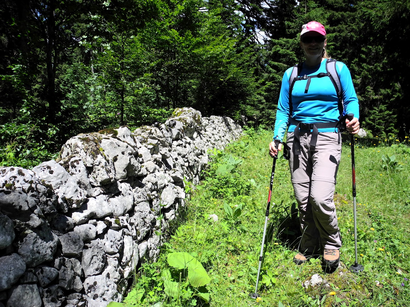
Lis alongside the stone wall we followed to the crest of Mondisé.
Breath-taking or not, it was a fantastic day for a walk in the Jura, so we had a good time tramping through the forest to and from today's destination.
The day had started with one of those magnificent Jura thunderstorms, with thunder and lightning and torrential rain hammering on the roof of our house in St George. I thought "there is no way we'll be going hiking today". The early-morning tempest reminded me of the graphic descriptions of storms over the Jura written by Lord Byron and other writers. In his epic 1812 poem Childe Harold's Pilgrimage, in which he devoted six verses to a storm that raged over Lac Léman between the Jura and the Alps, he wrote:
"The sky is changed! ... and such a change! Oh night,
And storm, and Darkness, ye are wonderous strong,
Yet lovely in your strength, as is the light
Of a dark eye in Woman! Far along,
From peak to peak, the rattling crags among
Leaps the live thunder! Not from one lone cloud,
But every mountain now hath found a tongue,
And Jura answers, through her misty shroud,
Back to the joyous Alps, who call to her aloud!
Inspired by both Lord Byron and the Jura, Mary Shelley also weaved a Jura storm into her epic tale "Frankenstein", which was largely set in Geneva:
"... we witnessed a most violent and terrible thunderstorm. It advanced from behind the mountains of the Jura; and the thunder burst at once with frightful loudness from various quarters of the heavens. I remained, while the storm lasted, watching its progress with curiosity and delight."
I had done the same from our living room this very morning, and yet by 1pm the storm had disappeared, the clouds had broken-up, the rain had stopped, and the sun promised to make this afternoon a delightful one for sofa-bound mountain trekkers.
Thus it was in glorious sunshine that we left the car parked at the lower car-park of the Col de Marchairuz (at 1447m), at the top of the mountain pass above St George, and headed off into the Jura forest on a skinny "goat-track" trail.

The auberge at the Col de Marchairuz.
The skies wavering between grey clouds and patches of blue.
The first thing that registered strongly about this walk was the wildflowers, and, by the end of the day, it was also the last thing. They were absolutely spectacular, especially when captured in the patches of brilliant sunshine that interspersed the dark periods brought on by scudding grey clouds.

Lis in a patch of classic white-petalled, yellow-centred daisies.
We headed northwest, following the trail that (according to the signpost at Col De Marchairuz, would take us towards La Fiorausax and Bière. That sounded about right, but I wasn't too worried, being armed with two topographic maps of this region, plus a new Garmin Dakota 20 GPS. Being lost, or as I prefer to say: being "temporarily uncertain of my position", in the Jura Mountains was now a thing of the past. The trail meandered its way just south of Mont de Bière Devant (1520m), then onto a forest road that zig-zagged its way down an escarpment through the Bois de la Sauge (which kind of means a patch of forest which is wet enough for willows to grow). The highlight of this trek down through the forest was spotting a red deer grazing in the undergrowth. That was very cool.
Never a big fan of going downhill when you know you're trying to reach somewhere uphill, I was relieved when we finally bottomed-out in the valley at crossroads near a farmhouse called La Foirausax (1337m). I photographed the signpost to record the moment, then we turned north and headed towards Crêt de Mondisé.

I love these trail signs. Maybe it's the yellow?
We soon after passed by the La Foirausax farmhouse, where I paused just long enough to get a photograph of the mountain home with Mont de Bière Devant (which I climbed on a wild, snowy, winter's day in January) in the background.

La Foirausax, with Mont de Bière Devant in the background.

Another view of La Foirausax and Mont de Bière Devant.
A little further down the road, which was by now heading back uphill onto the small La Correntine ridgeline, we turned off the regular walking trail, and headed into the alpine pasturage of La Correntine, another Jura Mountain farm. Soon after we had passed through the front gate, we sought-out an ancient stone wall just to our west - which the topographic map showed would lead us all the way to the top of Crêt de Mondisé - which is exactly what it did.
We followed the wall, weaving our way through the lovely firs and non-lovely cowpats, up hill and down dale, until we'd passed the La Correntine homestead (1439m), and a small ski chalet which was right up against our stone wall path. We waved, and bid our "bonjours" to the surprised family who were enjoying its solitude (until we turned-up of course), and then pushed-on towards the crest of the hill in front of us. At about 3pm, two hours after we'd left the car-park at Col de Marchairuz, we stood at the previously mentioned inauspicious summit. The origins of the name of the summit is uncertain, but is believed to have been derived from the Celtic words des, das, desi - which means a hill or hillock.
Nondescript it might be, but it was our destination, our summit, and it called for a celebratory photograph, cup of tea and lying-back-in-the-grass-sense-of-satisfaction. The sun streamed over the countryside and life was good. Surrounded by huge fir trees, the views of the surrounding countryside were glimpses at best. The town of Bière lay somewhere just to our south-southeast, and Mont Tendre to our north.

Ricardo, un wannabe nouveau homme de Suisse,
in the Crêt de Mondisé summit herbfield.
in the Crêt de Mondisé summit herbfield.
We sat back for awhile, drank some tea, chewed some trail mix, enjoyed the scenery, and checked the maps for our route back to the car. It wasn't obvious. We left the summit at about 1.30pm, headed north for just a hundred metres or thereabouts, until we intersected another old dry stone wall (heading west) which we followed. We plunged into some rugged, stony undergrowth adjacent to this wall, but it took us where we wanted to go - down the west side of the Crêt into the combe of Pre de St Livres and its "Petit Pre".

Getting directions from one of the locals.
From there we "took the road less travelled", and plunged into the forest on an absolute goat track that led into Creux d'Enfer de Petit Cunay. "Creux" means a hollow, and "enfer" means a narrow and deep valley, a mountain gully. It comes from the Latin word infernus which means "from below". It also means "Hell", which was probably more apt, given the number of sinkholes, rugged karst formations, and the general tough-going the trail provided, as we made our way back up the main escarpment towards the trail that would take us back to the Col du Marchairuz. This part of the Jura is well-known for its numerous caves, including the largest in Switzerland, most of which are hidden behind the Jura's veils of forest, mist, clouds and snow. There are two of these in this area - the Glacier de Creux d'Enfer and the Glacière de St-Livres - both of which are sinkholes with permanent ice. There are a few of these underground glaciers in the Jura, surrounded by a landscape of jumbled limestone, moss-covered rocks, fissures and sinkholes. The caves are very popular with cavers. Not surprisingly, we were careful to watch where you're putting your feet as we scrambled through the dark and dank grottos and hollows. Somewhat "hellish" it might have been in a couple of places, it was also spectacularly fully decked with summer wildflowers wherever the forest canopy was sufficiently peeled-back to let the sunlight penetrate and the herbfields predominate.

Lis in a wildflower bed adjacent to the trail
just above Creux d'Enfer du Petit Cunay.
The "Petit Cunay" part of this story pertains to the nearby farm of the same name. Confusingly, there's a nearby peak called Grand Cunay (which we climbed on the Mont Tendre hike in January), but there is no actual "Petit Cunay" summit. The Petit Cunay farmhouse is located at 1522m, directly east of Grand Cunay and west of Crêt de Mondisé, (i.e., right between the two). Just to the east of the farmhouse is a small hilltop (1548m), but it's not called the "Petit Cunay", it's unnamed. Similarly, the location on the trail between Col du Marchairuz and Mont Tendre where the Cabane du Cunay is located is also called "Petit Cunay" ... but there's no summit there either.
Despite my best efforts to find something that might resemble this phantom, "missing" peak; right on cue, at about 1550 metres, we came across the forest trail that would take us to the top of the ridgeline near the Cabane du Cunay. The cabane is a Club Alpine Suisse refuge hut - located at 1588 metres, on the main Col du Marchairuz to Mont Tendre Jura Crest Trail. We've passed by here a few times now - on previous Mont Tendre treks - but I still dropped-in to take a couple of photographs from its magnificent front deck vantage point.

The Cabane du Cunay mountain hut (1588m).

A view through the forest towards the crest of Crêt de Mondisé.

The Petit Cunay farmhouse (on the right, through the trees),
with the adjacent unnamed 1548m summit to its east (on the left).

Out the front of the Cabane du Canay mountain refuge.
The hilltop behind the cabane was looking a bit like a construction site - which it was - as the federal government had recently commenced work on the new telecommunications tower they're building on the peak behind the cabane (following the widespread rejection of their previous idea to build it at the top of Mont Tendre). There's already an aerial at the top of this peak, so another, bigger one, won't be such a problem as a totally new eye-sore on Mont Tendre.
For the first time today, we began to encounter other hikers, most of whom appeared to be outbound - heading northwest towards Mont Tendre. We were going in the opposite direction - "inbound" - southeast towards the Col du Marchairuz.

Lis on the trail home with the summit of Grand Cunay (1603m) in the background.

Approaching the Cabane du Grand Cunay.
We passed through familiar country - past the Cabane du Grand Cunay (behind which, the highest point - just above the cabane which is at 1567m - was occupied by a mob of obviously scenery-appreciative mountain cows). Our next landmark was the Mont de Bière Derrière homestead (1520m) - where the resident family teased us with a smoky fire and its accompanying delicious aroma of barbecued boeuf, and the clink-clinking sound of beer bottles.

The Monts de Bière Derrière homestead and some unbarbecued boeuf.
A short stretch of undulating, sometimes "squidgy" underfoot, forest trail through the Bois du Marchairuz (fittingly, Marchairuz means a place where there are marshes or swampy ground) soon delivered us to the end of the trail, and we emerged from the forest at the hotel and restaurant at the top of the Col du Marchairuz. The huge puddles we'd been negotiating our way around on the trail were the legacy of last night's thunderstorm.

The end of the trail. The Col du Marchairuz.
It was now 5.30pm, four-and-a-half hours after we'd set out. It hadn't been a long walk, maybe 15 kilometres, but it had quite a bit of "off-road" trail-blazing - which sucked-up the minutes and left our legs feeling more weary than they should have. Despite the aches and pains, it had been another fab trek through the Jura. I'll leave the last words about the grandeur of the place to the famous English poet Percy Shelley and his poem "On the dark height of Jura":
"Ghosts of the dead! I not heard your yelling
Rise on the night-rolling breath of the blast,
When o'er the dark aether the tempest is swelling,
And on eddying whirlwind the thunder-peal passed?
For oft have I stood on the dark height of Jura,
Which frowns on the valley that opens beneath;
Oft have I braved the chill night-tempest's fury,
Whilst around me, I thought, echoed murmurs of death.
And now, whilst the winds of the mountain are howling,
O father! Thy voice seems to strike on mine ear;
In air whilst the tide of the night-storm is rolling,
It breaks on the pause of the elements' jar.
On the wing of the whirlwind which roars o'er the mountain
Perhaps rides the ghost of my sire who is dead:
On the mist of the tempest which hangs o'er the fountain,
Whilst a wreath of dark vapour encircles his head."

The logo of the Club Alpine Suisse at the Cabane du Cunay.
Jura peaks bagged:
- Crêt de Mondisé (No. 39) 1525m.
No comments:
Post a Comment