It's only appropriate that the first of my "seven highest summits" attempts would be on the one closest to home ... and the highest in Switzerland - Mont Tendre (1679m, the sixth highest peak in the Jura).
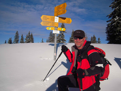
Getting an early start to this project, Lis and I strapped on our snow-shoes ("raquettes" in this part of the world) alongside the auberge at the Col du Marchairuz (1447m) and plunged into the Jura forest at 10am on Tuesday 3 January.
The sign said 2 hours 20 minutes, meaning the return trip should be about five hours, but that was for summer walking, so we were expecting something more like six hours - depending on the snow and the weather. The first part of the trail was easy going, with the path well defined and compacted by the hundreds of day-trippers who go up to the Col for a short stroll into the forest before heading back to the auberge for croissants and coffee (or something stronger). The "good" trail lasted as far as the (mostly) snow-buried farmhouse at Mont de Bière Derrière, which is the extent of most of the auberge-frequenting day-trippers' escapades into the Jura.

Just by being there we were officially at the "summit" of our first recognized Jura peak - Mont de Bière Derrière (at 1481m, and ranked 50th in the top 60 peaks of the Jura - even if it didn't feel much like a summit, and wasn't one of our top seven). Under a gorgeous blue sky and in glorious sunshine, we stopped only long enough for a photograph and to shed our jackets, before heading further northwest along the Chemin des Crêtes du Jura. About half an hour down the trail, we passed the Cabane du Grand Cunay (owned by the Le Brassus ski club), before arriving at the Grand Cunay farmhouse (1567m). It too was also mostly buried in snow, although we did manage to get under one of the eaves to get a pic of the signposts.

We soon chalked-up our second Jura summit for the day - Grand Cunay (at 1603m, and number 15 in the list of highest peaks). Grand Cunay has actually got twin peaks - one at 1574m (located just behind the farmhouse) and another at 1603m (unnamed on the topographic maps, and about 500 metres to the northeast). We took the obligatory photos at the first, clowning around a bit on the trig marker, then ploughed a new trail through the beautiful fresh snow to the second summit. The word Cunay comes from the Latin cuneis, cuneus - meaning wedge or pyramid, and entirely appropriate for something that warranted a place in the Jura's highest peaks. It also relates to the Roman words cunh, conh, cong which mean "corner, angle, acute" and refer perhaps to a landscape with a pointed apex or a location at the corner, edge of a forest. In accordance with these origins, there is an old French word coignet, which means a "small wedge".

From the second, tree-free and wind-buffeted summit, we got our first brilliant views of the huge span of the Alps, as they provided a dramatic backdrop above Lac Léman. As usual, Mont Blanc stood dominant above all of the others.

Once again we stopped to take some pics, and to appreciate some of the ice-encrusted, gnarled, twisted shapes of some of the most exposed dead trees, before plunging into fresh, deep snow in the valley ahead. This new trail provided us with a few "hairy" moments (read "tumbling-down head-first into the snow"), but some easy-going as well - being able to walk right over the normally imposing stone walls that criss-cross the Jura's highland pastures. Eventually we zig-zagged our way through the forest and back onto the main trail, and soon after walked past the Cabane du Cunay (1588m, owned by the Vallée de Joux section of the Club Alpine Suisse - CAS. Originally built in 1928, and renovated in 1937 and 1982, it's a very comfortable refuge in this neck of the woods). A little further down the trail we passed the Cabane Pivette (1563m), and soon after that, the Cabane du Servan (1555).

In the past, we've walked by this last cabane in mid-summer and seen people sitting outside, enjoying the sunshine and a glass of wine (dreaming now!), but today it was just mostly snow-covered and abandoned for the winter. Before long, we passed the last man-made, nature-buried, landmark on our route, the Chalet de Yens (1589m) from where we had our first good view of our destination - the summit of Mont Tendre. The only thing really standing in our way was a steep, icy traverse just above the "chalet" which had Lis' heart in her mouth as she gingerly inched her way across its slippery surface. Annoyingly, while it slowed our progress quite a bit, we were overtaken by a guy wearing an "Extreme" Mammut snow jacket on cross-country skis who made it look like child's play. I took a good hard look at his skis to see if he had some kind of invisible crampons or something on them, but no, he just knew what he was doing. We watched him pull away towards the summit, and then, once we were back onto fresh snow and more level ground, made our own final push up the steep slope to the top. We arrived at 13:15, three hours after leaving the Col.
We had planned to stay there for lunch, but the summit was being lashed by gale-force Arctic winds, so we stayed just long enough to get a commemorative photo under the trig-station pyramid at the summit (46 degrees 35' 40"N; 6 degrees 18' 36"E), before fleeing downhill while we still had some feeling left in our fingers.

As always at this time of the year, the summit was incredibly wind-scoured, and crusty with ice. It's hard to believe that, on a field trip up here in June 1966 members of the Cercle Vaudois de Botanique found 198 plant species. Of course many of those would have been in the dense coniferous forest further down the slope and back under the tree-line. For the botanists, the dominant species in this neck of the woods are Sapin blanc (or white fir - Albies alba), Sapin rouge (red fir - Piecea abies) and Genévrier commun (Common juniper - Juniperus communis). However, our only interest in the trees at the time was to find one to shelter under, out of the wind, where we could break-out our trusty thermos of hot tea, and sandwiches.
On a day blessed with much better weather, in 1856, the famous English writer and philosopher John Stuart Mill crested the Mont Tendre summit following a hike and climb from Le Pont alongside Lac de Joux. He wrote:
"... I say that after climbing the Mont Tendre, a most beautiful mountain, one of the highest in the Jura, which with a rest on the grass at the top and the return took six hours, I only staid (sic) half an hour to eat a crust of bread and drink a whole jug of milk, and set off again to climb another mountain and make a round which took another five hours - and I am not now more tired than is agreeable. The views of the Alps here are splendid, especially that from the Mont Tendre - in spite of a great deal of haze towards Berne and Savoy (Alps). I saw the snowy range for a great distance, Mont Blanc tolerably and the Dent du Midi, the nearer Valais mountains and the whole lake of Geneva from end to end well, also the lake of Neuchâtel, the whole Jura, and France I should think nearly to Dijon."

We were not so lucky. Instead of enjoying the views, we headed downhill as far as the first trees and found a swale a safe distance away from a nearby protective cornice and sat down for lunch. While there we were visited by only the second of the two trekkers we saw that far into the Jura that day - who (also geared-up as if he knew what he was doing - far from the madding crowd in the mountains at this time of the year) came past with a beautiful Bernese Mountain dog. We "ooooed" and "aaaaahed" about his dog as it wandered over to check-out what Lis was having for lunch. At the guy's request, we took a photo of him and his dog on his mobile phone, and soon watched them both disappear in the direction of Mont Tendre. We then sat back to absorb the absolute delight of being alone again in such a dramatic location in such a wild place.
Mont Tendre is another twin peak, hence I called it "Double en-tendre" ... and very appropriately too, having chosen to use "rambling" in the name of my blog. I'm not sure who named the mont, but in French "tendre" means a feeling of fondness or love; soft or tender (which the summit was anything but today ... being more of a "Mont Hard" or "Mont A-Little-Bit-Difficult"). There are various theories behind the origins of the name - including that the rocks here may be a little more friable than in other parts of the Jura; or that it comes from the Latin word tener, which means soft, or relatively soft ground. Another hypothesis is that it comes from another Latin word tendere, which means a broad peak composed of several ridges. Given its multi-peaked appearance, I tend to favour the latter.
But whatever the origins of the its nomenclature, it's a favourite destination of Jura walkers, many of whom helped "save" the summit from ruination in mid-2010 by joining a popular uprising against the Department of Defence which wanted to build a huge 25m communications aerial on the summit. A community group (Association pour la sauvegarde du Mont Tendre) was hastily formed and proceeded to make a lot of noise about the issue. Amongst other campaign strategies, they organized a number of protest rallies - including two at the summit. This was followed-up by a court injunction lodged by Pro Natura, WWF and a couple of other organizations, which ultimately led to the army abandoning its plans. (Apparently they decided to build the aerial on the top of Grand Cunay - which already has a number of aerials.)
But that was history, and now is now. We were freezing our butts off sitting in the snow and it was time to "get out of Dodge". So we shouldered our packs and headed-off. Lis headed downhill in one direction - to try to skirt around the slippery slope icy traverse - while I headed uphill, avoiding a precipitous-looking cornice, to the top of the second Mont Tendre peak. A quick glance to the east for a last glimpse of Mont Blanc and the Alps, then I made a bee-line for the Chalet de Yens where Lis and I had planned to rendezvous. Although the trail was non-existent this far from the auberge, we soon met-up, and started the trek back to the Col. By now the sun had disappeared, and a wall of black cloud was charging towards us from the direction of La Dole. We put our heads down and sloshed our way back down the trail as fast as we could go. Before long we were enveloped in a white mist and heavy condensation, and were forced to pull-on our snow goggles to be able to keep our eyes on the "road".
Fortunately, the conditions didn't get any worse, and we were able to make good time back to the Col, where we arrived in semi-darkness at about 16:15 (six hours after our departure). It had been a fabulous first walk and, although we'd done this walk twice before, this one had a feeling of being something special and a great way to kick-off a new year. One down, and six to go.
Jura Peaks bagged:
Getting an early start to this project, Lis and I strapped on our snow-shoes ("raquettes" in this part of the world) alongside the auberge at the Col du Marchairuz (1447m) and plunged into the Jura forest at 10am on Tuesday 3 January.

On the Chemin de Crêtes de Jura at
Col du Marchairuz - the start of the adventure.
The sign said 2 hours 20 minutes, meaning the return trip should be about five hours, but that was for summer walking, so we were expecting something more like six hours - depending on the snow and the weather. The first part of the trail was easy going, with the path well defined and compacted by the hundreds of day-trippers who go up to the Col for a short stroll into the forest before heading back to the auberge for croissants and coffee (or something stronger). The "good" trail lasted as far as the (mostly) snow-buried farmhouse at Mont de Bière Derrière, which is the extent of most of the auberge-frequenting day-trippers' escapades into the Jura.

Lis out front of the Mont de Bière Derrière farmhouse.
Just by being there we were officially at the "summit" of our first recognized Jura peak - Mont de Bière Derrière (at 1481m, and ranked 50th in the top 60 peaks of the Jura - even if it didn't feel much like a summit, and wasn't one of our top seven). Under a gorgeous blue sky and in glorious sunshine, we stopped only long enough for a photograph and to shed our jackets, before heading further northwest along the Chemin des Crêtes du Jura. About half an hour down the trail, we passed the Cabane du Grand Cunay (owned by the Le Brassus ski club), before arriving at the Grand Cunay farmhouse (1567m). It too was also mostly buried in snow, although we did manage to get under one of the eaves to get a pic of the signposts.

We soon chalked-up our second Jura summit for the day - Grand Cunay (at 1603m, and number 15 in the list of highest peaks). Grand Cunay has actually got twin peaks - one at 1574m (located just behind the farmhouse) and another at 1603m (unnamed on the topographic maps, and about 500 metres to the northeast). We took the obligatory photos at the first, clowning around a bit on the trig marker, then ploughed a new trail through the beautiful fresh snow to the second summit. The word Cunay comes from the Latin cuneis, cuneus - meaning wedge or pyramid, and entirely appropriate for something that warranted a place in the Jura's highest peaks. It also relates to the Roman words cunh, conh, cong which mean "corner, angle, acute" and refer perhaps to a landscape with a pointed apex or a location at the corner, edge of a forest. In accordance with these origins, there is an old French word coignet, which means a "small wedge".

Clowning around on the southwest summit of Grand Cunay (1574m),
with the unnamed second summit (1603m) in the background.
From the second, tree-free and wind-buffeted summit, we got our first brilliant views of the huge span of the Alps, as they provided a dramatic backdrop above Lac Léman. As usual, Mont Blanc stood dominant above all of the others.

Mont Blanc and the Alps above Lac Léman.
Once again we stopped to take some pics, and to appreciate some of the ice-encrusted, gnarled, twisted shapes of some of the most exposed dead trees, before plunging into fresh, deep snow in the valley ahead. This new trail provided us with a few "hairy" moments (read "tumbling-down head-first into the snow"), but some easy-going as well - being able to walk right over the normally imposing stone walls that criss-cross the Jura's highland pastures. Eventually we zig-zagged our way through the forest and back onto the main trail, and soon after walked past the Cabane du Cunay (1588m, owned by the Vallée de Joux section of the Club Alpine Suisse - CAS. Originally built in 1928, and renovated in 1937 and 1982, it's a very comfortable refuge in this neck of the woods). A little further down the trail we passed the Cabane Pivette (1563m), and soon after that, the Cabane du Servan (1555).

Lis on the trail near Cabane La Pivette.
In the past, we've walked by this last cabane in mid-summer and seen people sitting outside, enjoying the sunshine and a glass of wine (dreaming now!), but today it was just mostly snow-covered and abandoned for the winter. Before long, we passed the last man-made, nature-buried, landmark on our route, the Chalet de Yens (1589m) from where we had our first good view of our destination - the summit of Mont Tendre. The only thing really standing in our way was a steep, icy traverse just above the "chalet" which had Lis' heart in her mouth as she gingerly inched her way across its slippery surface. Annoyingly, while it slowed our progress quite a bit, we were overtaken by a guy wearing an "Extreme" Mammut snow jacket on cross-country skis who made it look like child's play. I took a good hard look at his skis to see if he had some kind of invisible crampons or something on them, but no, he just knew what he was doing. We watched him pull away towards the summit, and then, once we were back onto fresh snow and more level ground, made our own final push up the steep slope to the top. We arrived at 13:15, three hours after leaving the Col.
We had planned to stay there for lunch, but the summit was being lashed by gale-force Arctic winds, so we stayed just long enough to get a commemorative photo under the trig-station pyramid at the summit (46 degrees 35' 40"N; 6 degrees 18' 36"E), before fleeing downhill while we still had some feeling left in our fingers.

Intrepid explorer at the frigid, polar-like summit of Mont Tendre (1679m
and one of only two peaks in the Jura above the tree-line).
To give you an indication of how bumpy this country is,
it's ranked as the 6,106th highest mountain in Switzerland.
As always at this time of the year, the summit was incredibly wind-scoured, and crusty with ice. It's hard to believe that, on a field trip up here in June 1966 members of the Cercle Vaudois de Botanique found 198 plant species. Of course many of those would have been in the dense coniferous forest further down the slope and back under the tree-line. For the botanists, the dominant species in this neck of the woods are Sapin blanc (or white fir - Albies alba), Sapin rouge (red fir - Piecea abies) and Genévrier commun (Common juniper - Juniperus communis). However, our only interest in the trees at the time was to find one to shelter under, out of the wind, where we could break-out our trusty thermos of hot tea, and sandwiches.
On a day blessed with much better weather, in 1856, the famous English writer and philosopher John Stuart Mill crested the Mont Tendre summit following a hike and climb from Le Pont alongside Lac de Joux. He wrote:
"... I say that after climbing the Mont Tendre, a most beautiful mountain, one of the highest in the Jura, which with a rest on the grass at the top and the return took six hours, I only staid (sic) half an hour to eat a crust of bread and drink a whole jug of milk, and set off again to climb another mountain and make a round which took another five hours - and I am not now more tired than is agreeable. The views of the Alps here are splendid, especially that from the Mont Tendre - in spite of a great deal of haze towards Berne and Savoy (Alps). I saw the snowy range for a great distance, Mont Blanc tolerably and the Dent du Midi, the nearer Valais mountains and the whole lake of Geneva from end to end well, also the lake of Neuchâtel, the whole Jura, and France I should think nearly to Dijon."

Lis in the Mont Tendre dining room.
We were not so lucky. Instead of enjoying the views, we headed downhill as far as the first trees and found a swale a safe distance away from a nearby protective cornice and sat down for lunch. While there we were visited by only the second of the two trekkers we saw that far into the Jura that day - who (also geared-up as if he knew what he was doing - far from the madding crowd in the mountains at this time of the year) came past with a beautiful Bernese Mountain dog. We "ooooed" and "aaaaahed" about his dog as it wandered over to check-out what Lis was having for lunch. At the guy's request, we took a photo of him and his dog on his mobile phone, and soon watched them both disappear in the direction of Mont Tendre. We then sat back to absorb the absolute delight of being alone again in such a dramatic location in such a wild place.
Mont Tendre is another twin peak, hence I called it "Double en-tendre" ... and very appropriately too, having chosen to use "rambling" in the name of my blog. I'm not sure who named the mont, but in French "tendre" means a feeling of fondness or love; soft or tender (which the summit was anything but today ... being more of a "Mont Hard" or "Mont A-Little-Bit-Difficult"). There are various theories behind the origins of the name - including that the rocks here may be a little more friable than in other parts of the Jura; or that it comes from the Latin word tener, which means soft, or relatively soft ground. Another hypothesis is that it comes from another Latin word tendere, which means a broad peak composed of several ridges. Given its multi-peaked appearance, I tend to favour the latter.
But whatever the origins of the its nomenclature, it's a favourite destination of Jura walkers, many of whom helped "save" the summit from ruination in mid-2010 by joining a popular uprising against the Department of Defence which wanted to build a huge 25m communications aerial on the summit. A community group (Association pour la sauvegarde du Mont Tendre) was hastily formed and proceeded to make a lot of noise about the issue. Amongst other campaign strategies, they organized a number of protest rallies - including two at the summit. This was followed-up by a court injunction lodged by Pro Natura, WWF and a couple of other organizations, which ultimately led to the army abandoning its plans. (Apparently they decided to build the aerial on the top of Grand Cunay - which already has a number of aerials.)
But that was history, and now is now. We were freezing our butts off sitting in the snow and it was time to "get out of Dodge". So we shouldered our packs and headed-off. Lis headed downhill in one direction - to try to skirt around the slippery slope icy traverse - while I headed uphill, avoiding a precipitous-looking cornice, to the top of the second Mont Tendre peak. A quick glance to the east for a last glimpse of Mont Blanc and the Alps, then I made a bee-line for the Chalet de Yens where Lis and I had planned to rendezvous. Although the trail was non-existent this far from the auberge, we soon met-up, and started the trek back to the Col. By now the sun had disappeared, and a wall of black cloud was charging towards us from the direction of La Dole. We put our heads down and sloshed our way back down the trail as fast as we could go. Before long we were enveloped in a white mist and heavy condensation, and were forced to pull-on our snow goggles to be able to keep our eyes on the "road".
Fortunately, the conditions didn't get any worse, and we were able to make good time back to the Col, where we arrived in semi-darkness at about 16:15 (six hours after our departure). It had been a fabulous first walk and, although we'd done this walk twice before, this one had a feeling of being something special and a great way to kick-off a new year. One down, and six to go.
Jura Peaks bagged:
- Mont Tendre (No. 6) 1679m
- Grand Cunay (No. 15) 1603m
- Mont de Bière Derrière (No. 50) 1481m
- According to the folks at the mountainsmount.com website, Mont Tendre is ranked the 36,457th highest mountain in the world (of the 106,826 mountains on their register :) It's the 6,106th highest mountain in Switzerland.
- Just below the summit of Mt Tendre there is a little tin shack perched among the rocks and set back into the rocky cliff-face. Not surprisingly, it's called the "Cabane du Rocher".
No comments:
Post a Comment